Otter Trail Hike – 29th June 2023
Event Date: 𝟐𝟗𝐭𝐡 𝐉𝐮𝐧𝐞 – 𝟑𝐫𝐝 𝐉𝐮𝐥𝐲 𝟐𝟎𝟐𝟑
𝐒𝐞𝐥𝐟-𝐆𝐮𝐢𝐝𝐞𝐝 – 𝐎𝐭𝐭𝐞𝐫 𝐓𝐫𝐚𝐢𝐥 – 𝟒𝟓𝐤𝐦 – 𝟓 𝐃𝐚𝐲𝐬 / 𝟒 𝐍𝐢𝐠𝐡𝐭𝐬 – 𝐆𝐚𝐫𝐝𝐞𝐧 𝐑𝐨𝐮𝐭𝐞
Start: Storms River Mouth
Finish: De Vasselot Rest Camp (Nature’s Valley)
Duration: 45km over five days and four-nights
Fitness: Need to be moderately fit; some may consider it tough
Beauty: 4/5
Self-Guided: Yes
Our tip: take extra pairs of socks as there are numerous river crossings
Accommodation: Basic huts, mattresses, no electricity
Cancellations / Refunds: No cancellations or Refunds. Substitutes welcome.
General Information
- Check-in: Allow some time to weigh your bag and watch the 20-minute Otter Trail DVD in the Otter Room next to the Storms River Reception building. The Otter Trail DVD provides a brief outline of changes recently made to the trail.
- Check out: Compulsory check out at De Vasselot Rest Camp where Otter Trail certificates will be issued.
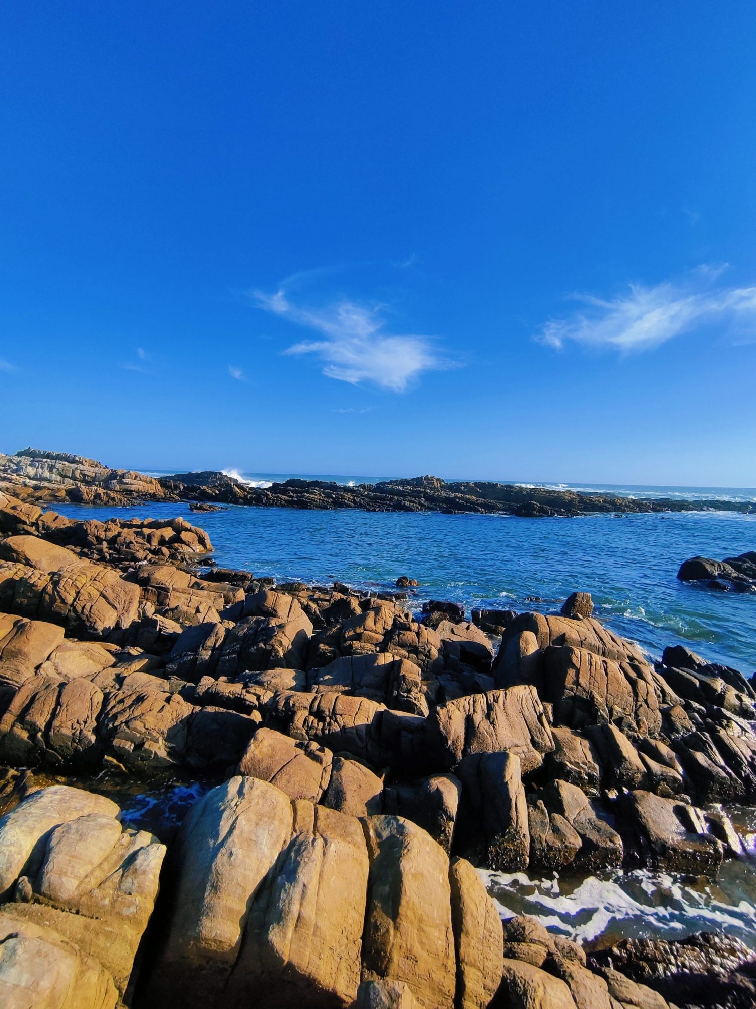
The Otter Trail is located entirely inside the Tsitsikamma National Park. The trail is right in the middle of the famous Garden Route and is hiked from the coastal side of the Garden Route, another one of South Africa’s most famous attractions, and is named for the Cape clawless otter in this region.
The Otter Trail is a hiking trail along the Garden Route coast of South Africa and is named for the Cape clawless otter which inhabits this region. You will sometimes spot the otters as they live in the many estuaries and streams in the area. This trail is widely regarded as one of the finest in the world and stretches from Storms River Mouth in the east to Nature’s Valley in the west, it is 26 km long as the crow flies and 45 km as the hiker walks.
Walking the trail takes 5 days, and the 4 nights are spent in comfortable huts with superb views. The route is located entirely within the Tsitsikamma National Park, which protects an 80 km-long strip of coastal mountains, forests, and beaches. The trail traverses a very scenic landscape, never straying far from the shoreline, but often climbing steeply and descending to the beach or a river crossing.
Vegetation along the way is either fynbos, dense gallery forest, or open, rocky sections near the sea with an abundance of wildflowers.
Trail landmarks: Storms River Mouth Ngubu huts Oakhurst huts Scott hut André huts Grootrivier, Nature’s ValleyTrail stages
Distance and Duration
Day 1 = 4.8km (± 2 hours) Ngubu Huts
Day 2 = 7.9km (± 4 hours) Scott Huts
Day 3 = 7.7km (± 4 hours) Oakhurst huts
Day 4 = 13.8km (± 6 hours) André huts
Day 5 = 10.8km (± 5 hours) Nature’s Valley
Total Distance = 45km
Parking, Shuttle Service and Porterage Services
You have two options; to leave your car at the starting point, Storms River Mouth National Park, or at the finish, Nature’s Valley National Park. In any case, you’ll need a shuttle to get either to the trail or back to your car. Both parking spots are inside the National parks and is quite safe to leave your car there. If you’re a group of hikers and drive in two cars, you can leave one car on each side.
As for the Shuttle and Porterage Services, there are a few providers; you can contact any listed below; Burton: +27 73 800 6811, Eli: +27 63 933 7010, Wild Compass Experiences: +27 61 009 3643, Vernon from Tranquility.
If it’s too far to drive from your hometown to the Storms River Mouth Park or you are a tourist and don’t have your own car, you can fly to George and rent a car at the airport or get local transport.
Water
There are numerous streams and springs throughout the length of the Otter Trail that is suitable for drinking purposes. Please note though that water from the Kleinbos River is not suitable for drinking (2nd day of trail). However, it may be wise to use purification tablets especially if you are not used to this water and where streams/rivers pass through communities such as the Coldstream/Witels River (3.6km mark of the 4th day) and the Lottering River (7.5km mark of the 4th day). There are rainwater tanks at each overnight hut that may also be used. However, due to erratic rainfall patterns, the level of these tanks may be low from time to time. Water quality is monitored on a quarterly basis.
Firewood
Firewood is provided, however, it is not covered from rain and therefore may be wet. Hikers are required to carry their share of wood from a woodpile, close by on the trail. However, it sometimes happens that there is a buildup of excess wood not used by previous hikers that is placed under the steps of the huts, which is usually dry.
Cooking facilities
Each hut has a braai place with a sturdy steel grid. Within each hut, there is a table on which food can be prepared. Hikers need to provide their own gas stoves and pots for cooking.
Other Facilities
There are two huts and a single toilet at each overnight stop. Each of the two huts contains 6 beds with mattresses – hikers must provide their own blankets/pillows/sleeping bags etc. Rubbish bins are provided at each of the overnight stops. Field rangers remove the rubbish regularly. There are benches present. Please only use biodegradable soaps on the trail. Hikers are not permitted to remove mattresses from the huts.
Tides
It is important to be aware of the dates and the times of the high and low tides prior to hiking the Otter Trail. This is especially important when it comes to crossing the bigger rivers such as the Elandsbos and the Bloukrans Rivers. It is the hiker’s responsibility to obtain tide tables in order to prepare for their hike.
The Bloukrans River Crossing
The Bloukrans River crossing is on the 4th day of the Otter Trail. It is approximately 10km from Oakhurst Hut which takes about four and a half hours (4.5) to reach. This river is best crossed during low tide. Once the river has been crossed it is approximately another 3.8km (two and a half hours) to the next overnight stop. It is wise to arrive well before low tide so that enough time is available to plan your crossing.
If you are unable to cross the river, you can take the escape route labeled E6. This escape route branches to the right of the trail just before the Otter Trail descends to the Bloukrans River Mouth. The escape route climbs steeply to the top of the plateau. In the case of an emergency, hikers are advised to make their way to the top of the escape route and wait for collection by SANParks Rangers once contact has been made. Do not attempt to walk to the N2.
Trail Map
At a glance
Check in: Allow some time to weigh your bag and watch the 20 minute Otter Trail DVD at the Otter Room next to the Storms River Reception building. The Otter Trail DVD provides a brief outline of changes recently made to the trail.