

How to Read a Topo Map
You probably know that a magnetized compass and a paper map are part of the Ten Essentials. Learning to read that paper topo map (short for topographic map) is every bit as essential. Your map will then be able to tell you a richly detailed tale about the terrain you’ll be exploring.
This article covers these concepts:
- How contour lines let you visualize your terrain
- How map scales work
- Other useful map details
- Where to find topo maps
Also read our companion article, How to Use a Compass. Then take a class with the ADJAFRICA Outdoor School or another outdoor organization and practice these skills until you master them.
Video: How to Read a Topo Map
How Contour Lines Describe Terrain
Simple trail maps are useful for trip planning but NOT for navigation in the field. Topographic maps go further, giving you the power to visualize three-dimensional terrain from a flat piece of paper. The feature that makes this possible is contour lines:
Contour lines indicate the steepness of the terrain. Contour lines connect points that share the same elevation: Where they’re close together (they never intersect), elevation is changing rapidly in a short distance and the terrain is steep. Where contour lines are wide apart, elevation is changing slowly, indicating a gentle slope.

Contour lines also indicate the shape of the terrain. Roughly concentric circles are probably showing you a peek, and areas between peaks are passes. Studying a topo map of a familiar area is a great way to learn how to match terrain features with the contour lines on a map.

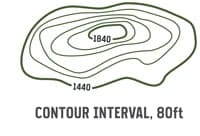
Index contour lines: Every fifth contour line is a thicker, “index” line. At some point along that line, its exact elevation is listed.
Contour interval: The change in elevation from one contour line to the next is always the same within the same map. Many maps have either a 40- or 80-foot contour interval: An 80-foot interval simply means that each contour line is 80 vertical feet away from the next closest line. You find the contour interval for your map in its legend.
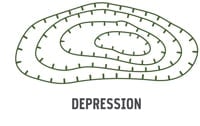 Every once in a while, a circle indicates a depression rather than a peak. A circle with tick marks inside it indicates a depression, rather than a peak. You should also see elevations decreasing as you get near the depression.
Map Scales
The map’s scale tells you how detailed your map is. A 1:24000 scale, for example, means one inch on the map equals 24,000 inches of real-world terrain. If the scale ratio had a number like 1:65,000, though, that would mean that each inch on the map covered 65,000 inches of terrain. A map with that scale covers a larger area overall—but it has less detail within each square inch on the map.
The terms “large scale” and “small scale” are often confused (including in an earlier version of this article). In the example above, for example, the correct description of the ratio of 1/24,000 is that it indicates the “larger scale” map (having greater detail). The ratio of 1/65,000 is the “smaller-scale” map (having less detail).

Maps also have a representative scale to help you visualize real-world distances. You can use this scale and a string or the edge of your compass to get a rough estimate of hiking distances on your map.
Other Useful Map Details
Look closely at the map legend. It’s loaded with map-reading clues and navigational data. Start by studying what each line, symbol, and color means. Generally, green indicates denser vegetation, while light or colorless areas suggest open terrain. And, as you’d expect, streams and lakes are shown in blue.
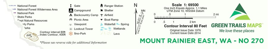
The legend also lists key data like the map’s scale, contour- and index-line intervals, grid systems (used for more advanced navigation), and magnetic declination (needed to set up your compass).

Practice reading features from a map of a familiar area. Visualize how the terrain on the major landmarks relates to the contour lines on your map. Pick out features like peaks and saddles. Identify subtler features like cliffs, which have contour lines grouped tightly together, and ridgelines, which connect peaks and have contour lines that decrease in elevation on each side. Valleys are low-elevation areas between ridgelines; some might have a creek running along the bottom, though that isn’t a requirement for a feature to be a valley.
Hone your map-reading skills on every trip. Pull it out at the trailhead, orient it correctly (see How to Use a Compass for details), and mentally check off landmarks as you hike. Regular map readers rarely get lost.
Where to Get Topo Maps

USGS Maps
The U.S. Geological Survey (USGS) used to be the gold standard for topo maps. Covering the entire country, its maps consisted of rectangular areas of land called quadrangles (“quads” for short).
Once available in most REI stores and other outdoor shops, preprinted USGS maps are being phased out now and replaced by an online resource that allows map data to be continually updated. Maps downloaded and printed from here have some major drawbacks: limited trail information and lack of in-the-field verification.
Maps from Specialty Companies
Several companies produce enhanced topographic maps. They highlight key features and update details regularly. These maps are more likely to be available for popular areas. (Finding a map for a lesser-known area will be more difficult.)
Additional features that can make a map more valuable include:
- Highlighted trails
- Elevation callouts
- Distances between trail junctions and landmarks
- Primitive trails
- Backcountry campsites
- Springs
- Highlighted boundary lines
Mapping Websites
Offering similar advantages to mapping software, a rapidly growing number of websites offer you the option to customize and download maps. Some are free; others are subscription-based.
Local Maps
Many public land areas (national parks, national forests, state parks, and recreational areas) produce maps to cover the land inside their boundaries. Check their websites to see if they offer printed or downloadable topographic maps for backcountry users.
All maps courtesy of Green Trails.
Author: REI
Related Posts

HIKING THE EPIC AMATOLA TRAIL – South Africa’s Most Challenging Trail
One of the most remarkable aspects of our journey was the ever-changing landscapes. From dense

Backpacking Food Hacks to Keep You Eating Well Anywhere
Reward yourself on your first day out with a delicious milkshake. Just grab a pint
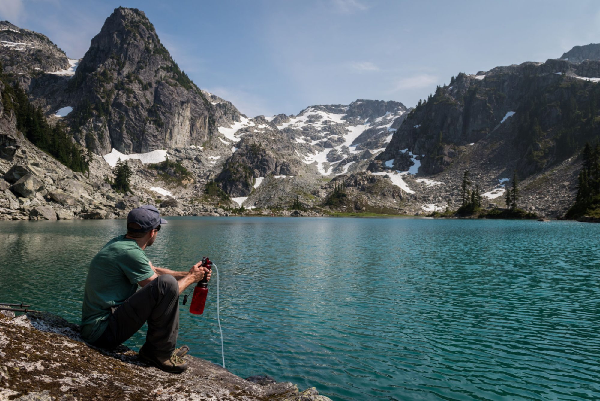
How to Choose a Water Filter or Purifier
Water purifiers also combat viruses, which are too tiny for most filters to effectively catch.